'Rocket fuel' in Gulf propelling Francine closer to hurricane status: Live updates
Life threatening conditions - if you can get north of Baton Rouge for a couple days then, no time like the present
'Rocket fuel' in Gulf propelling Francine closer to hurricane status: Live updates
USA TODAY
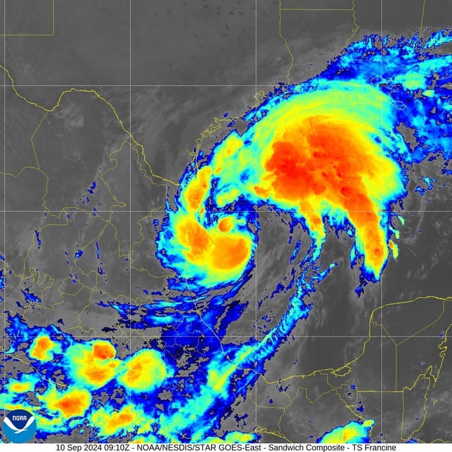
Tropical Storm Francine was growing more powerful Tuesday as it churned off the Texas Gulf Coast, forecast to reach hurricane status later in the day before slamming onto Louisiana's shore as a powerful force on Wednesday.
"The storm is starting to get its act together," AccuWeather hurricane expert Alex Dasilva said, adding that the high water temperatures in the Gulf were serving as "rocket fuel" for the system.
The National Hurricane Center said Francine was expected to sweep just offshore of Texas through Tuesday then roar into Louisiana before moving into Mississippi on Wednesday night or Thursday. Maximum sustained winds were already near 65 mph with higher gusts Tuesday. "Significant strengthening" was forecast before landfall.
Francine was expected to douse much of Louisiana an Mississippi with 4 to 8 inches of rain, and some areas could face a foot of rain through Friday morning that "could lead to considerable flash and urban flooding."
Developments:
∎ A few tornadoes are possible Wednesday in Louisiana, Mississippi, Alabama and the Florida Panhandle, the weather service said.
∎ Swells generated by Francine are expected to spread across the northwestern and northern Gulf of Mexico coastline Tuesday and Wednesday.
∎ Energy companies began evacuating offshore workers at several production platforms ahead of the storm. The port of Brownsville, Texas, was closed and others from Corpus Christi north to Galveston imposed restrictions.
Tropical Storm Francine: Storm approaching the US
In an area struck before, resident is ready
Rick Momin works at Bayaks Country Store in coastal Cameron Parish, which was devastated by two hurricanes just four years ago. Cameron may be in for another devastating storm strike, but Momin says he likes living in the area for the fishing and lifestyle. And he says he is ready for the storm.
"I know that every year somebody is going to get hit, so we have to take what comes," said Momin, 49. "It is Mother Nature. We live by the coast and it's coming."
Francine's winds could reach 100 mph
Thanks in part to unusually warm seawater in the Gulf of Mexico, Francine could even undergo what meteorologists call "rapid intensification," which occurs when a storm increases its wind speed by at least 35 mph within 24 hours. The hurricane center said sustained winds of 100 mph are possible near the storm center. However, while there's plenty of warm water for intensification, strong winds aloft could prevent strengthening.
"The tropical cyclone should be over very warm waters before landfall, although west-southwesterly vertical wind shear over the system is likely to increase," the hurricane center said in an online forecast Tuesday morning. "The latter environmental influence will probably limit Francine's strengthening."
New Orleans will face worst of Francine on Thursday
Francine is predicted to make landfall west of New Orleans, and tropical storm conditions are likely across the city, AccuWeather reported. The worst of the storm is likely to occur in New Orleans from 7 a.m. to 9 p.m. local time Wednesday. Wind gusts up to 60 mph and "more than a month’s worth of rain" were possible, AccuWeather warned. Up to 6 feet of storm surge could also cause flooding along Lake Pontchartrain.
The National Weather Service office in New Orleans warned that residents should complete preparations by Tuesday night.
"The weather will get worse overnight and continue to worsen through Wednesday," the office tweeted − with the silver lining of improving conditions Thursday.
Storm surge could push water levels to great heights
At 11 a.m. ET Tuesday the storm was centered 120 miles southeast of the mouth of the Rio Grande River and 425 miles southwest of Morgan City, Louisiana. Francine was heading north-northeast at 8 mph.
"There is a danger of life-threatening storm surge for portions of the Upper Texas and Louisiana coastlines," the hurricane center advisory warned, adding that evacuation orders could result. "Damaging and life-threatening hurricane-force winds are expected in portions of southern Louisiana."
Parts of Louisiana were bracing for torrential rains and high winds. Storm surge combined with high tides could push water levels in some areas 10 feet above ground, the weather service warned.
Louisana recovering from hurricanes Laura, Delta
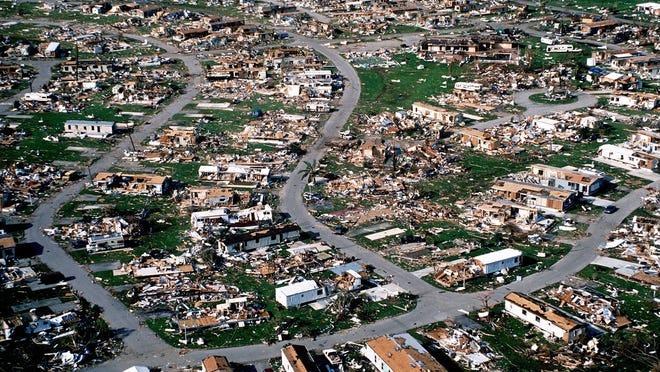
Parts of southwest Louisiana are still recovering from the double disaster in 2020 imposed by Hurricanes Laura and, six weeks later, Hurricane Delta. The two storms combined to kill at least 49 people in the U.S. and Caribbean and caused more than $20 billion in damage, most of it in Louisiana. Laura made landfall near Cameron, where forecasters say Francine may crash onto land.
In Lake Charles, 50 miles north of Cameron, just days ago a 22-story skyscraper damaged beyond repair by the hurricanes was taken down during a planned demolition. The Hertz Tower had been the city's tallest building.
Francine is the sixth named storm of the season
Francine is the sixth named storm of the 2024 Atlantic hurricane season, and the first since Ernesto dissipated on Aug. 20.
The system is one of three the hurricane center is watching. Another is in the central tropical Atlantic and is given a 40% chance of becoming a tropical storm within 48 hours. A storm farther to the east has a 70% chance of development over the next week.
Contributing: Dinah Voyles Pulver and Doyle Rice, USA TODAY; Reuters
https://www.usatoday.com/story/news/nation/2024/09/10/francine-storm-hurricane-warning-live-updates/75154874007/


