Future Tropical Storm Helene A Hurricane Danger To Florida, Gulf Coast; Alerts Issued In Cancun
By Jonathan Erdman
less than an hour ago
0 of 50 secondsVolume 90%
At a Glance
Tropical Storm Helene will develop soon in the western Caribbean Sea.
It is likely to be a hurricane in the Gulf of Mexico by Wednesday.
Most forecast models suggest a hurricane landfall in Florida or the northern Gulf Coast Thursday.
The hurricane could be strong at landfall with life-threatening storm surge, high winds and heavy rain.
Impacts could push well inland in parts of the South into Friday.
Sign up for the Morning Brief email newsletter to get weekday updates from The Weather Channel and our meteorologists.
Tropical Storm Helene is expected to form in the western Caribbean Sea and could intensify into a strong hurricane before it strikes Florida or the northern Gulf Coast later this week.
Interests along the U.S. Gulf Coast from Louisiana to Florida should monitor this situation closely, stay updated on how the forecast unfolds in the days ahead and have their hurricane plans ready to go.
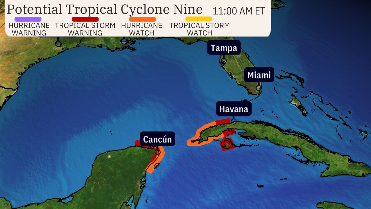
New watches and warnings issued: A hurricane watch and tropical storm warning have been issued for parts of Mexico's Yucatan Peninsula, from just west of Cancún to Tulum, including Cozumel. They are also in effect for parts of western Cuba.
This means tropical storm conditions are expected and hurricane conditions are possible in these areas within the next 36-48 hours.
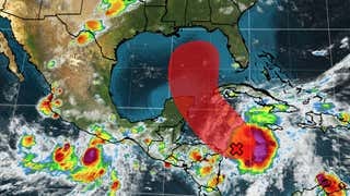
Where it is right now: A broad area of low pressure is in the western Caribbean Sea. Thunderstorms are gradually becoming more organized in this area.
It's been dubbed Potential Tropical Cyclone Nine, a procedure NHC uses to issue watches and warnings ahead of time, before a tropical depression or storm forms.
Here is the timeline:
- Monday-Tuesday: A tropical depression or storm could form as soon as late Monday or Tuesday. By late Tuesday, Helene could near Cancún, Cozumel and western Cuba as either a tropical storm or even a Category 1 hurricane. Locally heavy rain, strong wind gusts and storm surge flooding are possible in those areas. Parts of western Cuba could pick up 12 inches of rain or more.
- Wednesday: Helene could have some lingering impacts in Cancún, Cozumel and western Cuba, especially early. We then expect Helene to enter the southern Gulf of Mexico as a hurricane. Some high surf and outer rainbands could reach parts of Florida's Gulf Coast from the Keys to the Panhandle.
- Thursday: While still some uncertainty in the forecast, we expect Helene to make landfall as a strong hurricane Thursday afternoon or evening. While computer forecast models suggest the most likely location for a landfall is somewhere from Florida's Big Bend to the Panhandle, remember that hurricane impacts (surge, winds, rain) often happen far from the center. There are still a few computer ensemble model forecasts with tracks as far east as Florida's West Coast and as far west as southeast Louisiana or Mississippi. So, everyone along the northern Gulf Coast from Louisiana to Florida should continue to monitor this forecast for any possible changes ahead.
- Friday: This system is most likely to push quickly well inland with some lingering strong wind gusts and locally flooding rain over parts of the Southeast.
(Further beef up your forecast with our detailed, hour-by-hour breakdown for the next 8 days – only available on our Premium Pro experience.)
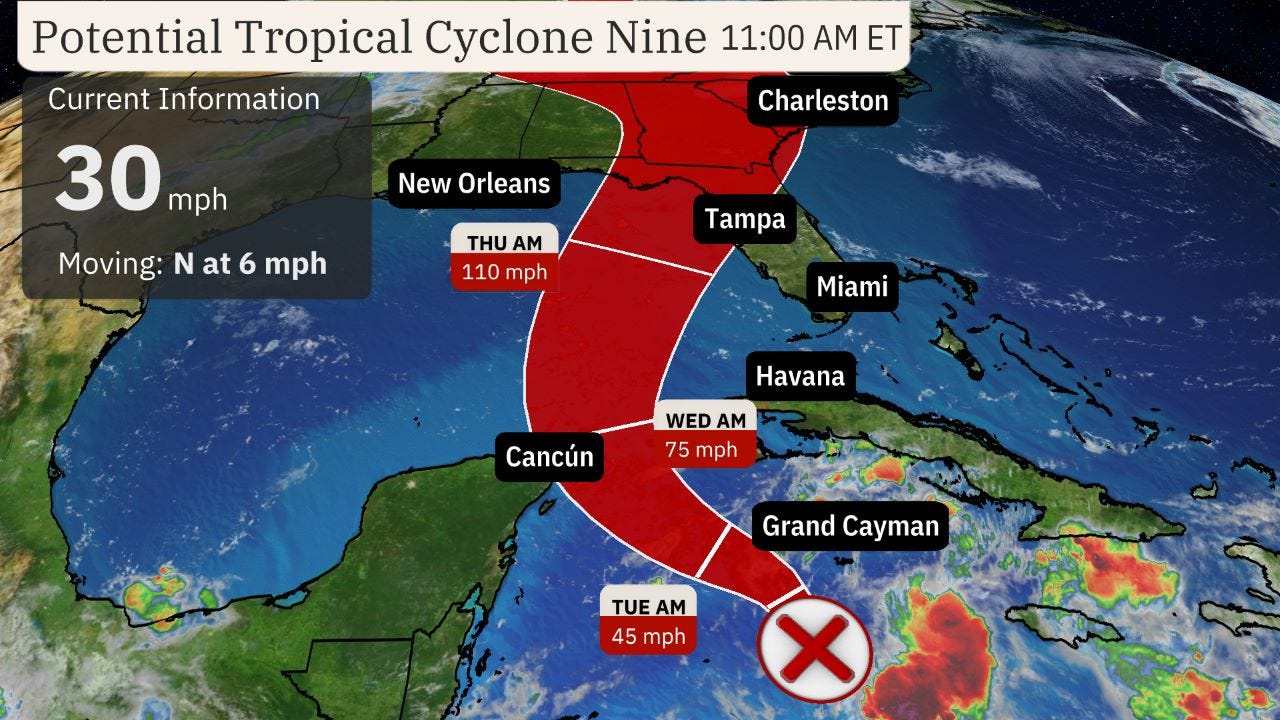
How strong could it become: Helene could become a formidably strong hurricane in the Gulf.
That's because heat content is one favorable ingredient for intensification, and the map below shows there is plenty of deep, warm water in the northwest Caribbean Sea and parts of the Gulf of Mexico. In fact, Gulf of Mexico heat content is at record high levels for this time of year, according to University of Miami tropical scientist Brian McNoldy.
(For even more granular weather data tracking in your area, view your 15-minute details forecast in our Premium Pro experience.)
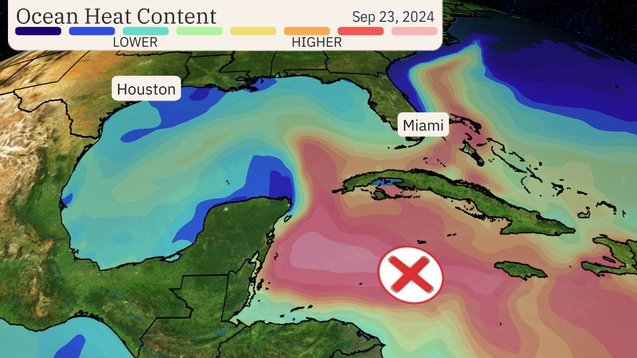
But it's not just warm water.
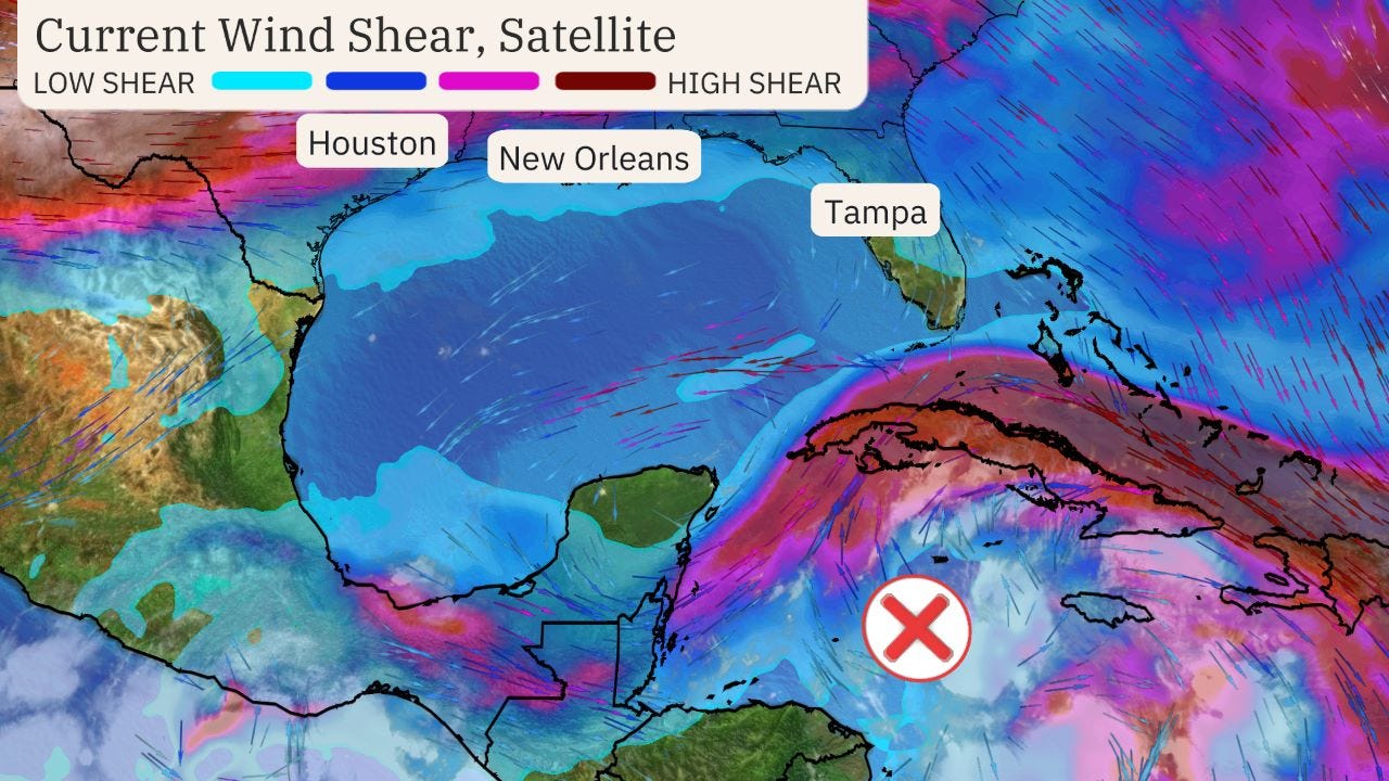
Forecast models suggest upper level winds could spread apart over Helene, which is favorable for strengthening, instead of shearing and tilting Helene's circulation.
For those reasons, Helene could reach at least Category 3 intensity in the eastern Gulf of Mexico before landfall.
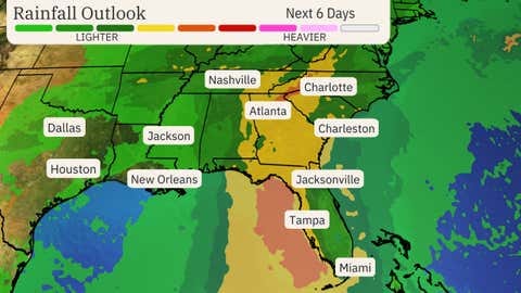
U.S. rainfall potential: While it's too soon for specifics on other impacts - including storm surge and winds - we expect Helene to produce heavy rainfall generally along and to the east of its track.
The heaviest rain is expected Thursday into Friday in parts of the Southeast, but some bands of heavy rain could arrive as early as Wednesday. This rain could lead to flash flooding, especially where it combines with storm surge and over higher terrain.
https://weather.com/storms/hurricane/news/2024-09-23-tropical-storm-hurricane-helene-forecast-gulf-florida
https://edition.cnn.com/2024/09/23/weather/helene-tropical-storm-hurricane-forecast-climate/index.html


